Urban planning
Tools that seek to improve urban planning processes by digitizing them and making them more accessible to residents.
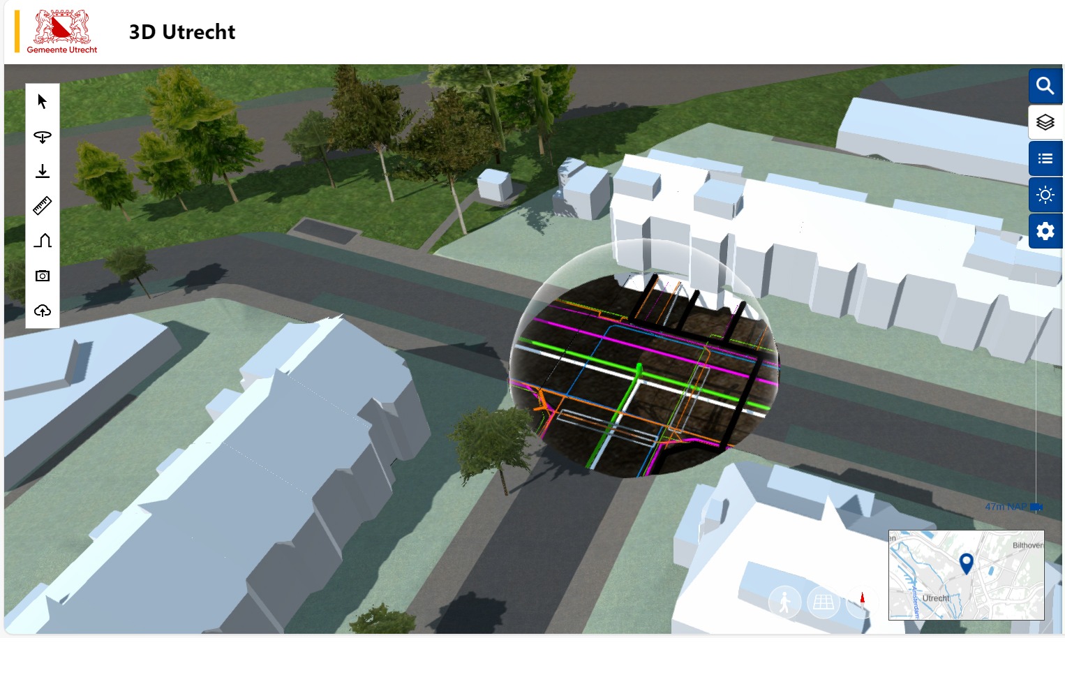
3D Utretcht
An interactive 3D model of everything from buildings and parks to underground infrastructure, used by city officials, researchers, and residents to visualise changes and assess their impact before imp...
.jpg)
Open Space Sandbox
Like a city-building game—but real life. Open Space Sandbox turns play into planning data
Placemaking Europe
Placemaking Europe is a European network that connects practitioners, academics, community leaders, market players and policy makers across the field of placemaking.
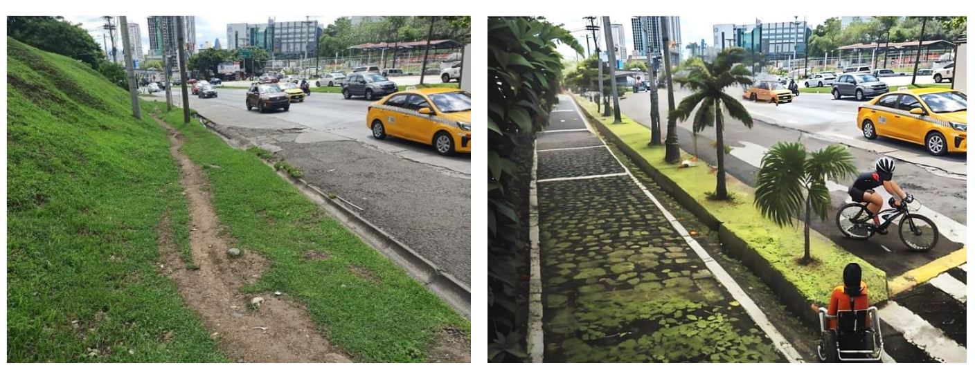
UrbanistAI workshops in Panama City
Participants worked in mixed-age groups, using UrbanistAI to redesign public spaces based on photographs they had taken themselves.
Blitz AI
Blitz helps you automate plan reviews to expedite building permits and approvals for homes, offices and commercial buildings across the USA with our AI-powered pre-check and plan review software.
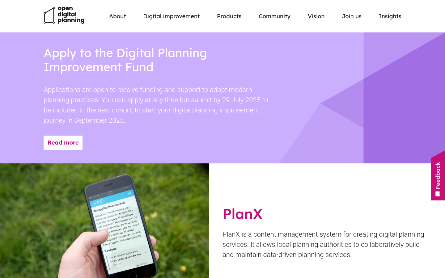
PlanX (Open Digital Planning)
PlanX is a content management system for creating digital planning services. It allows local planning authorities to collaboratively build and maintain data-driven planning services.
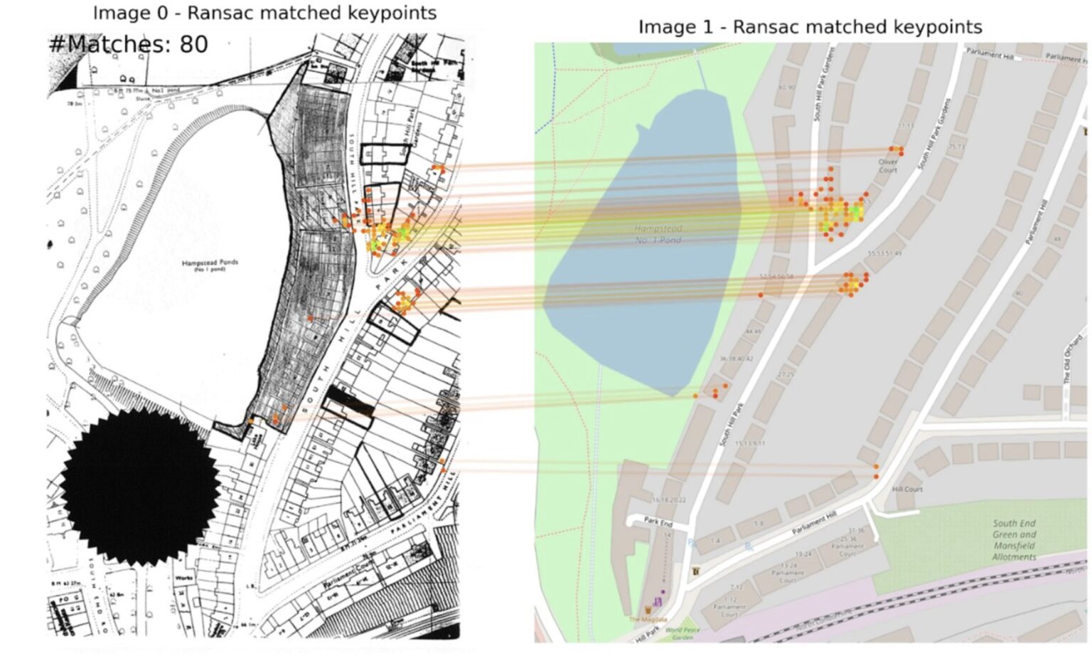
Extract
Using AI to unlock historic planning data
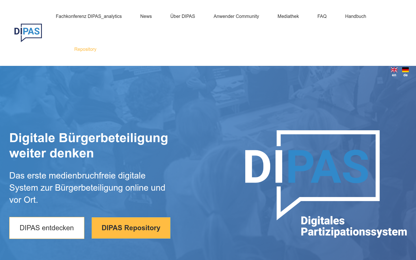
DIPAS
Das erste medienbruchfreie digitale System zur Bürgerbeteiligung online und vor Ort. DIPAS entdecken DIPAS Repository

Urban In Mind
Urban in Mind is a trusted urban planning consultant serving the Greater Toronto Area.

Miami-Dade County SMART Curbs Program
+(1).png)
Boston Curb Usage Map
To solve these challenges, the Streets Cabinet and Innovation and Technology Cabinet are building a digital map of Boston’s complex curb network and regulations.

Streetwise Technology
Pedestrian-first traffic management solutions

Planning and housing data in England
Official government portal for open planning and housing data

InformedDECISION™
a groundbreaking AI-based decision support platform, which is transforming decision-making processes for planning proposals on sensitive land.

Governing in the Age of AI: Reimagining Local Government
In this paper, we examine how AI could help reimagine local government.

Searchland
The ultimate platform for the real estate sector

GOV.UK document digitization tool
A new AI tool aims to modernise council planning by replacing outdated paper systems with high-quality digital data, enabling faster, smarter decisions to support the government’s goal of building 1.5...

Local plan policy tool
Local plan policy tool

Genie AI
The Genie AI team has created an easy step-by-step guide which takes you through every aspect of drafting your Section 106 Agreement.

Levelling-up and Regeneration Act 2023 Bill
Requiring open digitalisation and publication of planning data in the UK

Virtual Bradford
an open digital twin for the City of Bradford

Open Digital Planning
A community of forward-thinking Local Planning Authorities working together to shape a more efficient, data-driven planning system.
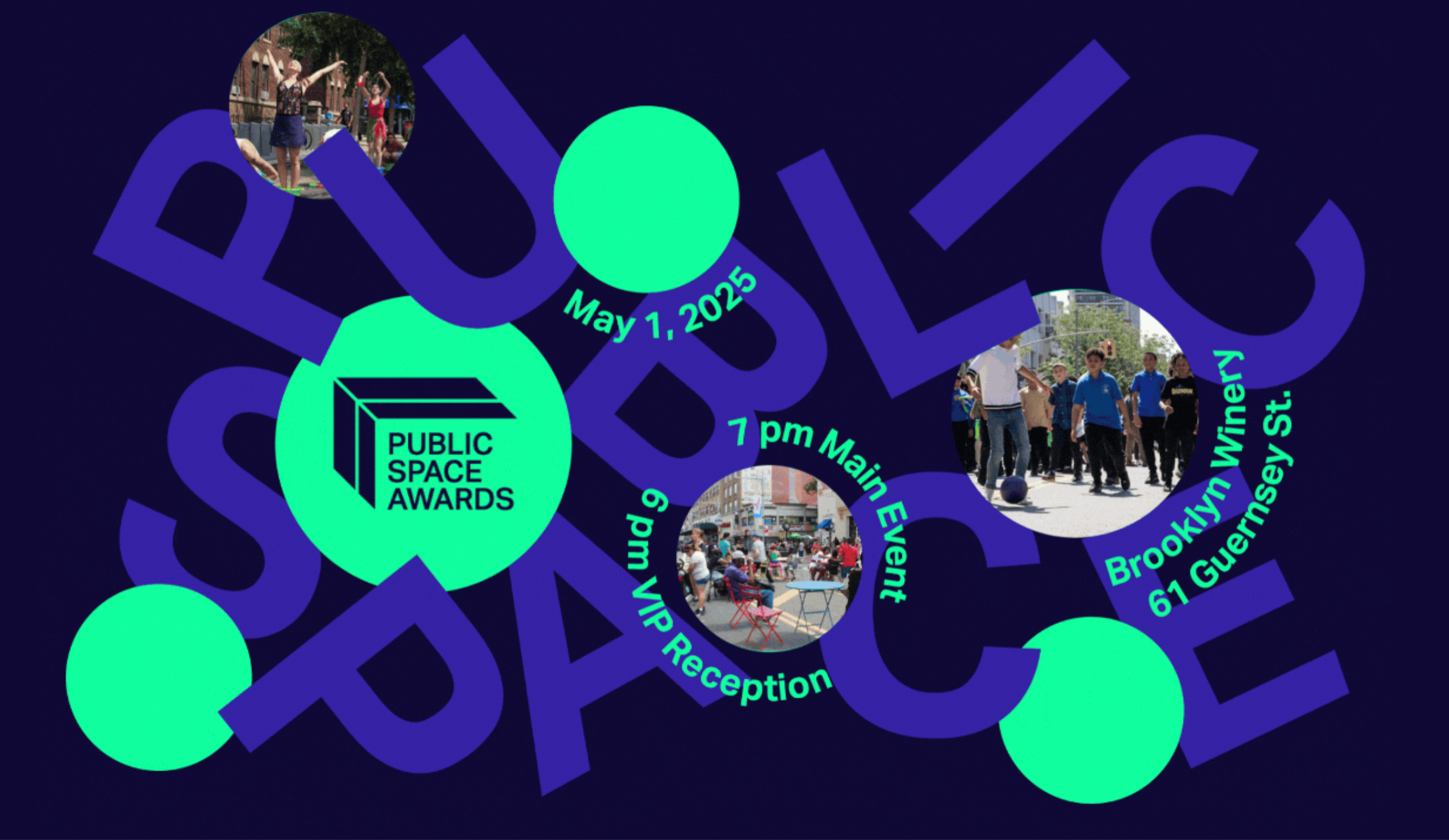
Public Space Awards
Come and join the Open Plans community on Thursday, May 1st for a festive celebration of the people behind our city’s defining public spaces.

Hey Neighbour Collective
Hey Neighbour Collective (HNC) is a collective impact project that brings together housing providers, researchers, local and regional governments, housing associations and health authorities to experi...
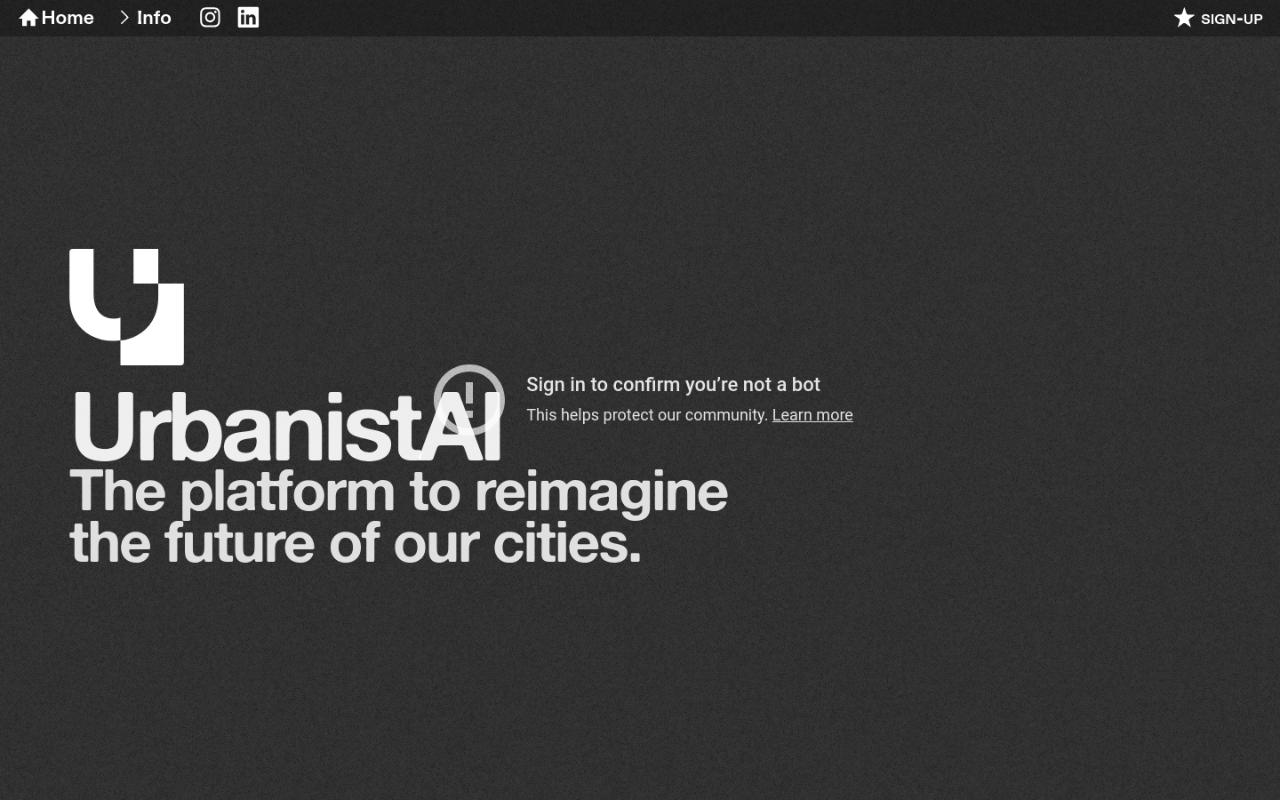
UrbanistAI
The platform to reimagine the future of our cities.

GAMA Platform
GAMA is an easy-to-use open source modeling and simulation environment for creating spatially explicit agent-based simulations.

Diagonal Works
We strive to support the development of more equitable and inclusive places through our belief in open, collaborative and data informed urbanism.

Community-Centered Planning for Mobility as Social Service
The project will establish a workshop to bring community-centered planning to the emerging technology of autonomous vehicles (AV)

PIX4D
Georeferenced Guassian Splatting for drones to reproduce thin and tricky structures with clarity.

When 'doing ethics' meets public procurement of smart city technology – an Amsterdam case study
[A] multi-stakeholder co-design project – including a citizen panel – is an integral part of the process in which the service is designed and realized

Sidekick
In plain language, tell Sidekick what you want to know and get answers straight from the mySidewalk data library.

The Atlas of Urban Tech
A global atlas of case studies of tech-enabled urban districts and municipal digital masterplans.

Street Activity Sensors
8-month pilot to test 12 computer-vision sensors across four boroughs of NYC to employ machine vision and improve street-level data collection and improve planning decisions

The Planning London Datahub
The Planning DataHub is a collaborative project between all of the Planning Authorities in London to build a single open data set of development proposals in the planning process to enable monitoring...

PlanIt
UK PlanIt is a national aggregator for current and historical planning information.

PlanningAlerts
Find out for free what is being built and knocked down in your area and receive email alerts when something new is planned.

Civic Infrastructure Collaborative
Civic Infrastructure Collaborative drives public value from core urban infrastructure through cross-sector collaboration and technology-enabled innovation.

Citify
Citify is an online platform designed to track planned and existing real estate projects, ranging from apartment complexes and business centers to streets, bike paths, parks, and schools.

Kur Gyvenu
It's a platform aimed at helping people find information about various neighborhoods and districts in Lithuanian cities.

Urban Platform
A web solution designed for governments that provides the digital twin of the city, and delivers a real-time view of every street, plus insightful analytics to support decision-making and increase th...

Infrastructure Space
Infrastructure Space was established in 2017 to acknowledge the infrastructural turn in architectural theory, to embrace the thinking and methods established in L+U and [Re_Map] and to explore new ter...

BlackSpace
We break the silos of urbanist practices to build Black power and Black joy.

Lacuna
A transportation operating system for orchestrating, governing, and powering modern mobility.

Tile2Net
"an end-to-end open-source framework for creating georeferenced pedestrian networks from aerial imagery"

Tactical Urbanism Materials and Design Guide
An open guide promoting participatory urban planning

Custodianship in the Urban Commons
BARI has worked closely with the Mayor’s Office of New urban Mechanics and the 311 system examine how Bostonians contribute to the maintenance of the public spaces and infrastructure of neighborhoods—...

“Seeing” Neighborhoods through “Big” Data
Modern administrative data—from 311 and 911 calls to building permit applications to Tweets—offer a detailed view of events and conditions across the city.

TwinMotion
A digital twin solution for buildings and urban planning that works with Autodesk

ClearRoad
ClearRoad provides cloud-based solutions to keep roads well-maintained and well-managed Schedule a demo

PlanX (UK)
Plan✕ is a platform for creating and publishing digital planning services. It aims to make planning less hard work, for everyone.