Mapping tools
Tooling and utilities for making civic maps

Mapistry
Created for businesses with air and water permits who want one software for inspections, emissions calculations, and reporting - that operations actually uses.

MyTownhall
A one-stop-shop for accessible local political knowledge and discussion (for small towns in the NJ-NY-PA area).
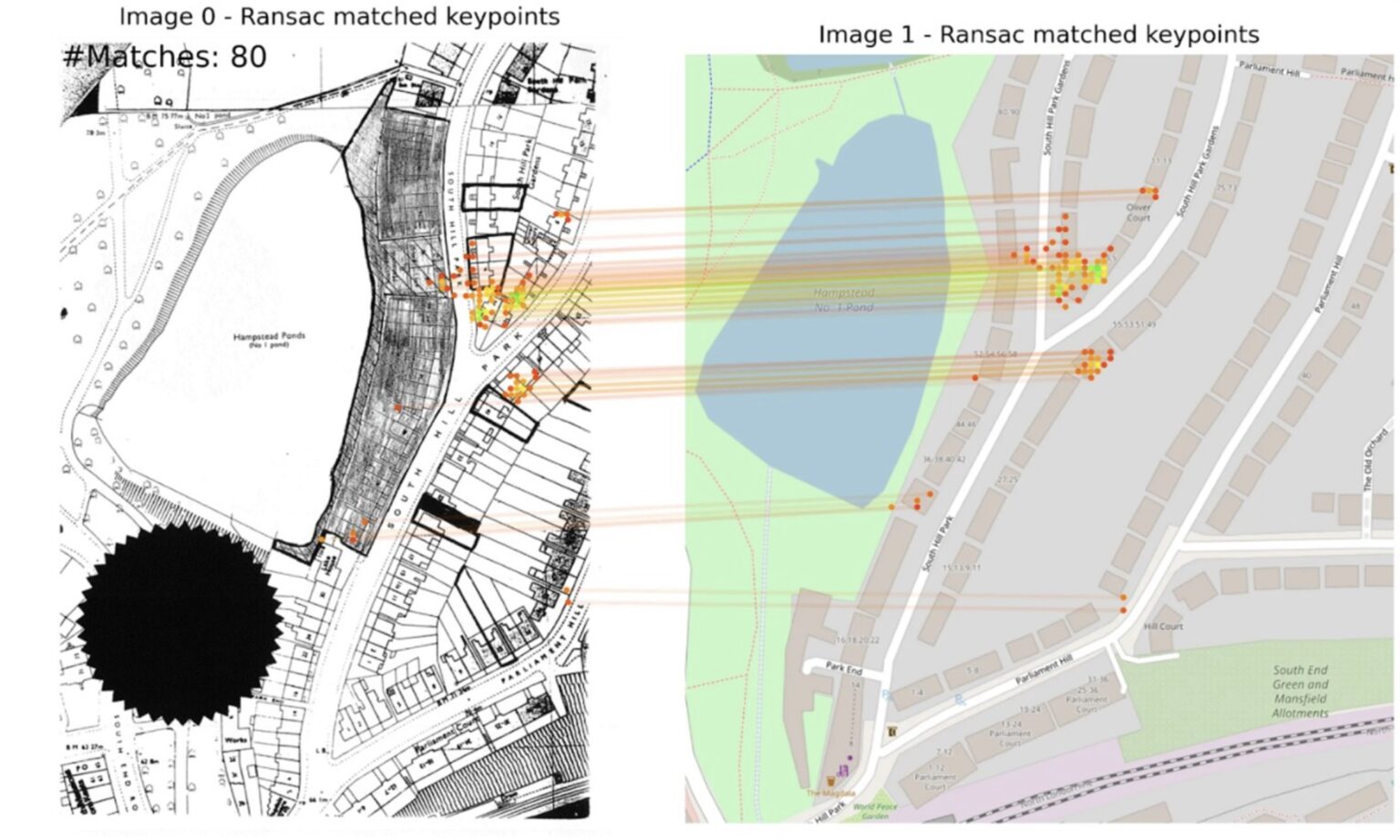
Allmaps
Allmaps makes it easier and more inspiring to curate, georeference and explore collections of digitized maps.
Extract
Using AI to unlock historic planning data

gvSIG Desktop
A powerful, user-friendly, interoperable GIS used by thousands of users worldwide.

Azmeh أزمة
تطبیق "أزمة" ھو تطبیق فلسطیني يعرض حالة الأزمات المرورية التي تفرضھا حواجز الاحتلال

Doroob
Updated maps by local staff from your community to match map frequent changes equiped by location services.

OpenGroupMap
OpenGroupMap is an open platform for creating and sharing collaborative maps. It enables communities, groups, and organizations to build shared geographic knowledge bases.

Verkehrszeichen in OpenStreetMap
Verkehrszeichen sind wertvolle Daten in OpenStreetMap.

Google Maps Platform
Google Cloud now offers Geospatial Analytics, Generative AI on Street View imagery, and more environmental data as part of the broader Google Maps Platform
Postcodes in Polygon
Datadaptive's Postcodes in Polygon tool allows users to draw an area on a map and retrieve a list of postcodes within that area in Great Britain, using data from the November 2024 release of the ONS P...

Restore the Gulf of Mexico
Updates Google Maps to show the Gulf of Mexico again.

GAMA Platform
GAMA is an easy-to-use open source modeling and simulation environment for creating spatially explicit agent-based simulations.

Debatomap / Carticipe
Un outil basé sur le retour d’expérience de sociologues et spécialistes de la concertation publique territoriale
OpenStreetMap Americana
A new OpenStreetMap style by the US chapter

GeoMSF Platform
A full suite of mapping and geodata tools developed by and for Medecins Sans Frontieres

Google Heat Resilience Tool
Google Research is applying AI to satellite and aerial imagery to build a Heat Resilience tool, helping cities understand how to reduce surface temperatures through planting trees or using highly-refl...
OpenDroneMap
We’re building sustainable solutions for collecting, processing, analyzing and displaying aerial data while supporting the communities built around them.

EveryDoor
EveryDoor is an OpenStreetMap editor for POIs and entrances.

Kepler
Kepler.gl is a powerful open source geospatial analysis tool for large-scale data sets.

MapSwipe
Swipe and tap. Put communities on the map. Help humanitarians find and help vulnerable people.

StoryMap
StoryMapJS is a free tool to help you tell stories on the web that highlight the locations of a series of events. Tells a story based on a series of singular point locations.

PIX4D
Georeferenced Guassian Splatting for drones to reproduce thin and tricky structures with clarity.

Field Tasking Manager (FieldTM)
FIeldTM allows for coordinating field mapping activities in Open Mapping campaigns. While there are existing field mapping applications, there is a lack of efficient tools to coordinate these activiti...

WheelMap
Mark and find wheelchair accessible places — worldwide and for free. Wheelmap is the map for wheelchair accessible places

MagicEarth
Turn-by-turn navigation, OpenStreetMap, Crowd-Sourced Traffic, 3D maps, Satellite maps, Offline maps and Transit. Entirely free.

StreetComplete
This app finds missing map data in your vicinity and displays it on a map as quests. Solve each quest by visiting the location on-site and answering a simple question to update the map.
Mapillary
Access street-level imagery and map data from all over the world. Fill in the gaps by capturing coverage yourself.

SketchMapTool
The Sketch Map Tool is an easy-to-use tool for participatory sketch mapping through offline collection, digitization and georeferencing of local spatial knowledge. The tool has a variety of applicatio...
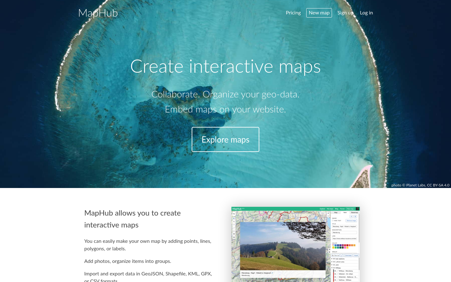
MapHub
MapHub allows you to create interactive maps

Mapeo
Mapeo is a free, easy-to-use, open source set of tools for collecting and mapping information. Mapeo was built by Digital Democracy with and for earth defenders to easily document environmental & huma...

HOT Export Tool
The Export Tool is an open service that creates customized extracts of up-to-date OSM data in various file formats.

Field Papers
Field Papers is a tool to help you create a multi-page atlas of anywhere in the world. Once you print it, you can take it outside, into the field, to record notes and observations about the area you'r...

MapRoulette
MapRoulette has dozens of mapping Challenges that are created by experienced mappers. Each Challenge is about improving OSM in one very specific way

Cloud-Native Geospatial Foundation
The Cloud-Native Geospatial Foundation encourages adoption of highly efficient and accessible approaches to working with geospatial data over the Internet.

TreeKIT
We’re helping city dwellers measure, map, and manage street trees.

PastMaps
Cutting-edge map tools for historical research. Search, explore, and discover the history of your surroundings through historical maps.

Karachi Chal
Your AI based Itinerary planner for the City of lights.
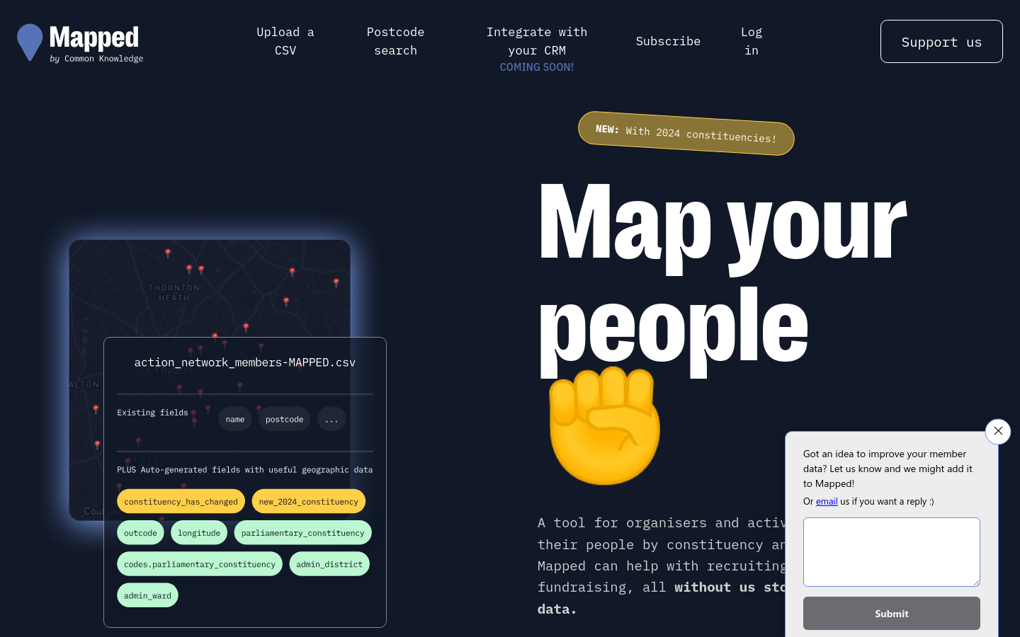
Mapped
Empowering organisers and activists with mapping tools and data enrichment ✊

OpenPV
Currently a solar potential look-up tool for the German state of Bavaria. "We support the roll-out of more photovoltaic roof systems."

Hurricane Mapping (Sea Island Software)
We are Sea Island Software, Inc., a company specializing in hurricane threat assessment. HurricaneMapping.com is our storm tracking service for Google Earth and ESRI's ArcGIS.

Postcode => Westminster constituency converter
Enter a UK postcode and this tool returns the constituency it belongs to

MapIt
The easy way to match points to boundaries

Murmurations
Making movements visible

Urban Analyst
Urban Analyst provides interactive maps of the properties of cities including of their transport systems and socio-demographic conditions, as well as statistical summaries of all cities.

Nappal hajtva
Information website by Budapest municipality in order to help the population find the possibilities of solar energy

Social Explorer
Gain deep insights into any location of interest through thousands of data variables and stunning visualizations. Reinforce your decisions with Social Explorer’s reliable data mapping capabilities....

PetaBencana.id
PetaBencana.id provides residents, government agencies, and first responders with a real-time disaster information sharing system at an unprecedented scale. It is the first platform of its kind to har...

UnmappedSmallTownUSA Mapstodon bot
Posting towns in the USA with a population less than 1000 that are undermapped on OpenStreetMap.org

HOT Tasking Manager
The tool to team up for mapping in OpenStreetMap